
Universal Plastic joins the UN Ocean Decade: connecting local action with ocean intelligence
Universal Plastic · 2026
Our project at Universal Plastic has been endorsed as a Decade Project by UNESCO’s Intergovernmental Oceanographic Commission. The endorsement connects our work to a global effort to advance ocean science and put it to use for a more sustainable future.
What is the UN Ocean Decade?
The United Nations Decade of Ocean Science for Sustainable Development, known as the UN Ocean Decade, runs from 2021 to 2030. Coordinated by UNESCO’s Intergovernmental Oceanographic Commission, it brings together scientists, policymakers, industry and civil society around a shared goal: generating the ocean science and knowledge needed to address ocean challenges and support sustainable development. Its guiding idea is “the science we need for the ocean we want.”
Our endorsed Decade Project is linked to the Ocean Practices for the Decade programme. That programme works to strengthen the development and adoption of ocean best practices, encourage methods and standards to work together, and make ocean knowledge more accessible.

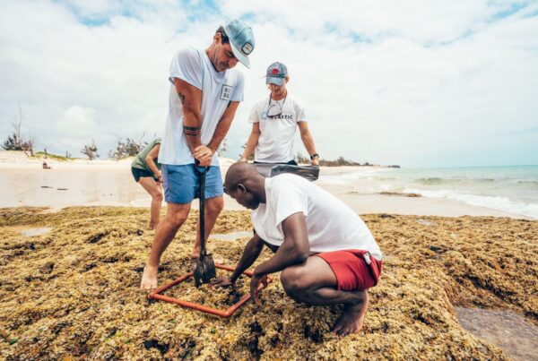
Ocean Defenders on the beach: citizens are at the heart of the data we collect.
From coastal observations to connected ocean intelligence
At Universal Plastic, we develop digital infrastructure to monitor marine plastic pollution and strengthen ocean resilience. Our work began with a practical question: how can we turn local plastic collection activities into evidence that helps us understand and protect the ocean?
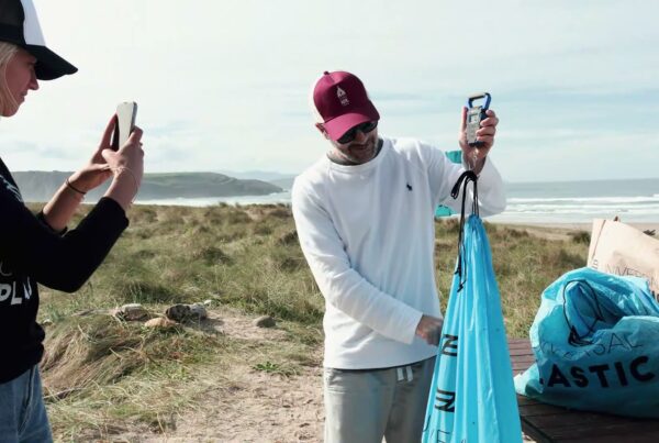
Our citizen science app is one answer, and it is now part of our endorsed UN Ocean Decade Project. It enables people and communities—our Ocean Defenders—to record collection activities with photographs, GPS locations and information about the plastic collected. Georeferenced, time-stamped records, together with AI-supported classification and integrity checks, help create a traceable account of what happened, where and when. Anyone can take part: the app is free to download from the App Store and Google Play, and registering collection data with it costs nothing. Our app is one of the main ways this connection works on the ground: every record Ocean Defenders submit becomes part of the wider data space, where it can be compared with other ocean datasets and reused by others. Because the app sits within our endorsed Decade Project, its records follow the same principles of traceability, interoperability and reuse promoted by the Ocean Practices for the Decade programme. In this way, each collection activity carried out with the app contributes directly to the UN Ocean Decade’s goal of generating the ocean science needed for the ocean we want.
But our infrastructure goes beyond an app. We connect field observations, scientific monitoring and analytical tools so that information does not remain isolated in separate projects or systems. The process has three connected stages: capturing evidence, connecting it through shared standards, and turning it into useful intelligence.
Locals using the app to capture data.
1. Bringing different sources of evidence together
Citizen-generated records provide an important view of what is happening along coastlines, but no single source can capture the whole picture. Our infrastructure also integrates evidence from drone-based coastal surveys, monitoring buoys and sensors, laboratory analyses, water samples, satellite observations and institutional datasets.
These sources offer different perspectives: a collection record documents a local activity, while water sampling and laboratory analysis can help characterise microplastic concentrations and polymer types. Connecting them creates a stronger foundation for understanding marine plastic pollution than viewing each dataset on its own, as we explored in Beyond the kilos.

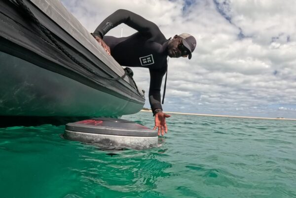
Monitoring buoys are one of the sources of evidence we bring together.

How the AI works: detecting and classifying different types of plastic in an image.
2. Connecting data without taking away ownership
Our Plastic Monitoring Data Space (PMDS) provides the shared framework that connects these sources. Rather than treating ocean data as something that must all be handed over to one central database, we use a federated approach: contributors retain ownership and control of their information while making it discoverable and usable under common rules and standards.
This matters because useful collaboration depends on trust as well as technology. Governments, researchers, businesses and communities need ways to exchange information without losing control over how it is accessed or used. Shared governance, traceability and interoperability (the ability of different systems to work together) are central to that approach.
Our data space is designed around FAIR principles, making data findable, accessible, interoperable and reusable. We also contribute to the Ocean Data and Information System (ODIS) Federation, connecting our work with a wider ocean data ecosystem. The goal is not simply to collect more information, but to make existing and new evidence easier to discover, compare and use.
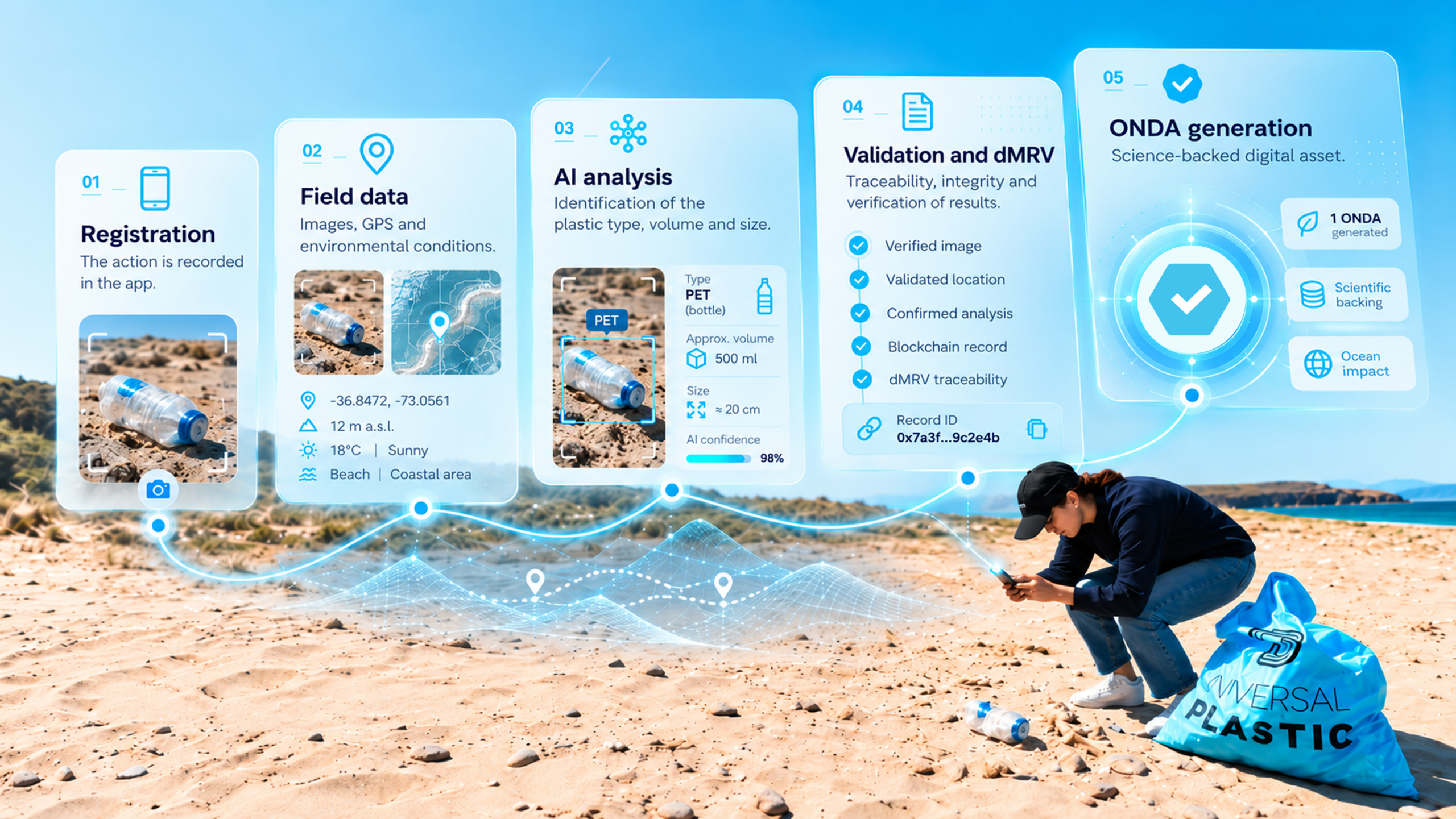
From a field record to a verified digital asset: how ONDAs work.
3. Turning connected evidence into decision support
Our Blue Resilience OS is the analytical layer of this infrastructure. It integrates, structures and correlates different datasets, helping translate raw environmental observations into indicators and impact assessments.
The results can be explored through dashboards, reports and interactive outputs, while structured results remain available through the data space for integration and further use. This connects the people generating evidence with the institutions and organisations that need it for monitoring, planning and decision-making.
For example, our Biodiversity Impact Index looks beyond the amount of plastic collected. It brings together biodiversity value, socioeconomic relevance, plastic risk reduction and blue carbon protection to help assess where collection efforts could deliver greater environmental and social benefit.
Blue Resilience OS turns connected data into indicators and decisions.

Impact map from the Biodiversity Impact Index.
Why collaboration and good practices matter
Marine plastic pollution is complex, and no single dataset or organisation can provide the whole picture. Better understanding depends on reliable observations, compatible methods and the ability to share and use information across communities and institutions.
Through our connection to Ocean Practices for the Decade, we join a wider community focused on improving how ocean knowledge is developed and applied. This is closely aligned with our work: connecting observations is only useful when the methods behind them are reliable, their origins are traceable and others can understand and reuse them.
As our project grows, this connection creates opportunities to exchange knowledge, learn from other ocean initiatives and contribute to practices that make data more useful and accessible. Our endorsed project is planned to run from January 2026 to January 2030 and contributes to Ocean Decade Challenges 1, 8 and 10.
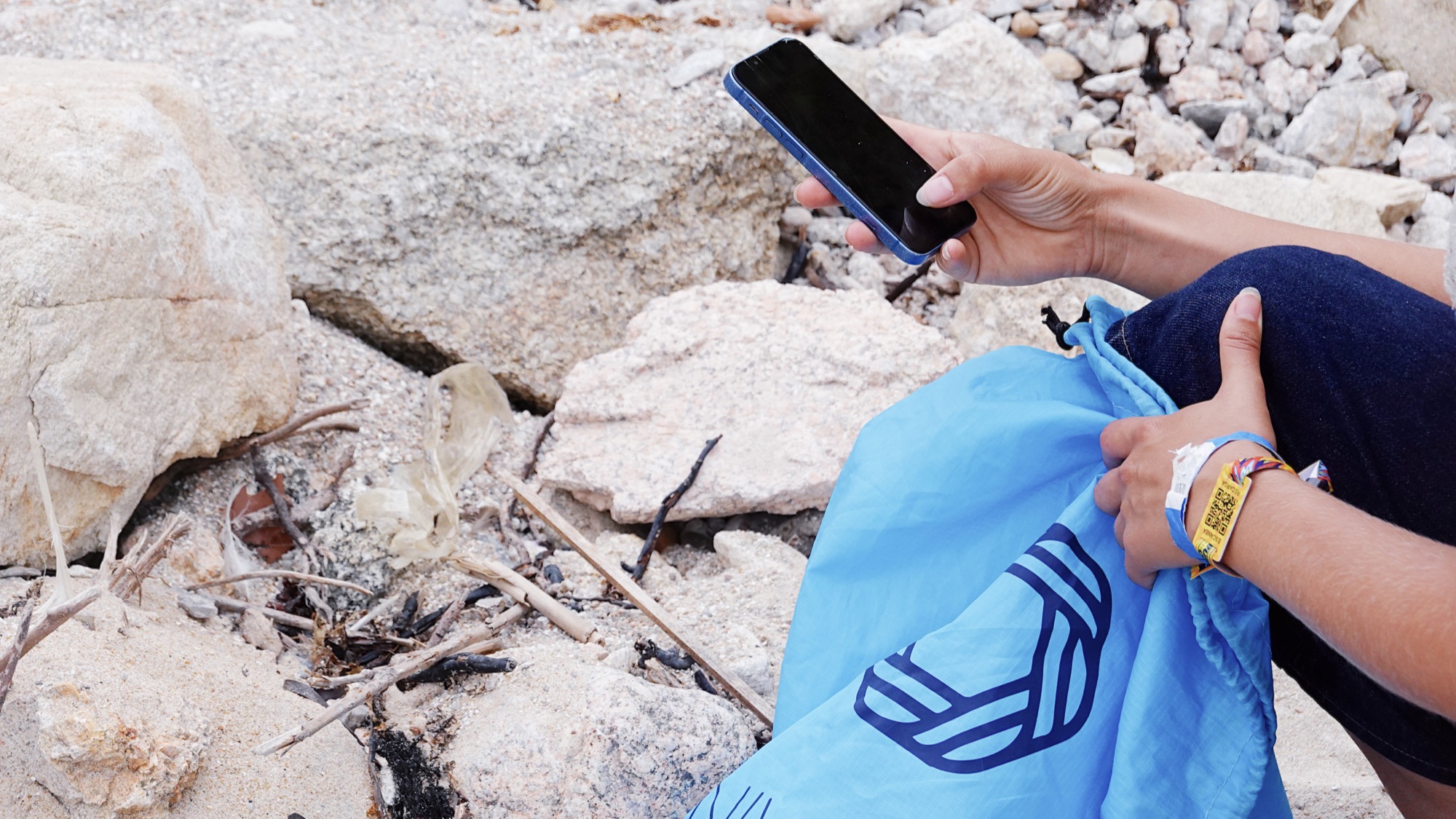
Volunteers with their phones and Universal Plastic bags during a beach collection.
From local action to ocean intelligence
Every coastal observation can add to a better understanding of marine plastic pollution. Our role is to help that evidence travel further: from a local collection activity or scientific sample, through a connected data space, to intelligence that can support monitoring, collaboration and better-informed decisions.
Our endorsement as a UN Ocean Decade Project marks an important step in that work. For us, it is a commitment to keep connecting community action, scientific evidence and digital infrastructure, and to help build the ocean knowledge we need for the future we want.

From local observation to a global ocean data ecosystem.
How do we measure the impact of removing plastic from the coast?
Discover how we are working to build a fuller picture of the impact of plastic pollution on biodiversity, ecosystems and the blue economy.