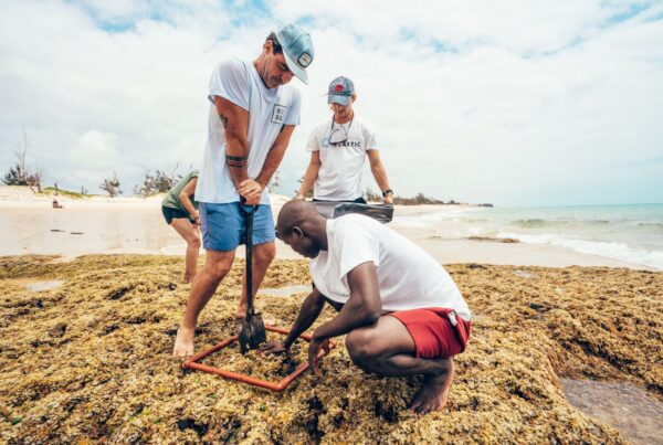
Turning fishing buoys into tools for ocean science
Universal Plastic · 2026
What happens when a tool designed for tuna fishing is given a second life in marine research? A study from the Bazaruto Archipelago in Mozambique shows how repurposed smart buoys can help scientists observe changes in marine life over time, and points to opportunities for connecting ocean observations with other environmental data.
The study, published in Scientific Reports (Lebrato et al., 2026), was led by Dr Mario Lebrato at the Bazaruto Center for Scientific Studies (BCSS) Ocean Observatory, in collaboration with Satlink and Universal Plastic.

Refurbished smart tuna-fishing buoys at the BCSS research station. Credit: BCSS Ocean Observatory.
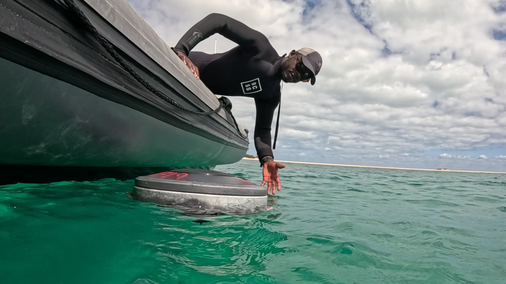
A repurposed smart buoy being handled at the surface in the Bazaruto Archipelago. Credit: BCSS Ocean Observatory.
A second life for fishing technology
Smart echosounder buoys are used by the tuna-fishing industry to locate fish and transmit information by satellite. Through Satlink’s Project ReCon, buoys that have reached the end of their fishing use can be recovered, refurbished and put to work in science rather than being discarded.
In June and July 2025, the research team deployed repurposed buoys at sites across the Bazaruto Archipelago, including coral reefs, seamounts, pinnacles and a shelf area. Some were held at fixed locations; others were used in controlled drifting surveys.
The buoys’ echosounders send acoustic pulses into the water and record the returning echoes. These observations provide an indication of the relative amount and distribution of marine life at different depths. The buoys transmitted the information by satellite in near real-time, while the BCSS Ocean Observatory supplied ocean and weather observations to help put the results in context.

Deployment of a smart buoy from a research boat. Credit: BCSS Ocean Observatory.

How a smart sonar buoy reads the ocean: an acoustic pulse becomes a profile of relative biomass by depth. Universal Plastic infographic (illustrative).

Figure 1. Deployment sites, smart-buoy system and sampling strategies in the Bazaruto Archipelago (Fig. 1 of the study). Source: Lebrato et al. (2026), Scientific Reports (CC BY 4.0). Credit: BCSS Ocean Observatory.
The study in numbers
Key figures of the deployments carried out in June and July 2025, according to the published article:
393
time-stamped acoustic records
1,281
depth-layer observations
115 m
maximum depth monitored
20–40%
stronger acoustic biomass signals at night
5
sites: 2 coral reefs, 2 seamounts or pinnacles and 1 shelf test area
51.5–96.2 h
of fixed-point acoustic record per site
20+
in-situ ocean and weather variables from the observatory
14–20
megafauna taxa recorded per site by scuba surveys
Source: Lebrato et al. (2026). The acoustic values are relative biomass/backscatter signals, not calibrated absolute biomass.
What the study found
The deployments produced 393 acoustic records and 1,281 depth-layer observations, with monitoring reaching down to 115 metres. Across the study sites, nighttime acoustic biomass signals were 20–40% stronger than daytime signals. The team also used independent dive surveys to document marine life at the main sites.
These results show the potential of the buoys to reveal changes over time and to complement other ways of studying marine ecosystems. They do not, however, identify individual species or measure the absolute amount of fish: the acoustic signals were not independently calibrated for those purposes. The research is a proof of concept based on short deployments; longer studies, biological calibration and consistent monitoring protocols are needed to develop further applications.

The Satlink software interface shows buoy positions and echosounder records transmitted by satellite. Credit: BCSS Ocean Observatory.

Figure 2. Depth-resolved biomass signals at fixed-point stations (Fig. 3 of the study). Source: Lebrato et al. (2026), Scientific Reports (CC BY 4.0). Credit: BCSS Ocean Observatory.

Independent scuba surveys documented the marine megafauna at the main sites. Credit: BCSS Ocean Observatory.

Figure 3. Megafauna community structure and diversity at each site (Fig. 5 of the study). Source: Lebrato et al. (2026), Scientific Reports (CC BY 4.0). Credit: BCSS Ocean Observatory.
Universal Plastic’s role and why this matters to us
Our contribution to the study included co-funding, through the EU’s NextGenerationEU programme (project SEDIA), and the participation of our colleague Álvaro Bravo as a co-author. Satlink provided the buoy technology, acoustic processing, satellite connectivity and software infrastructure; BCSS brought the scientific expertise and ocean-observatory infrastructure used to carry out the research.
For Universal Plastic, the study connects to a wider goal: helping turn environmental observations into evidence that can inform action. We develop digital infrastructure to monitor marine plastic pollution and help institutions and governments understand the pressures affecting ocean ecosystems. Plastic pollution is one part of a wider picture that also includes marine life and changing ocean conditions.
Working with BCSS, we are exploring how additional sensors and complementary technologies could support broader ocean monitoring, including plastic pollution. Bringing information on pollution, marine life and ocean conditions together could help build a more complete picture of where ecosystems face pressure and where action may be most useful, the direction behind Blue Resilience. It also builds on our earlier collaboration with the observatory, described in our post on the Bazaruto Ocean Observatory.

From echo returns to ocean knowledge: connecting signals over time. Universal Plastic infographic (illustrative).
From proof of concept to future observation
Ocean ecosystems change over time, but conventional surveys cannot always capture those changes continuously. Repurposed buoys offer a way to explore more frequent observations alongside established scientific methods—while also giving existing equipment a new purpose.
The Bazaruto study is an early step. Its value lies both in what the team observed and in the questions it opens for further research: how can longer deployments, complementary sensors and connected data help scientists and decision-makers better understand the ocean?
We are proud to have supported this collaborative work with BCSS and Satlink, and look forward to building on the knowledge it provides.

Figure 4. Modular smart-buoy observatory framework and its potential blue-economy applications, proposed by the authors (Fig. 6 of the study). Source: Lebrato et al. (2026), Scientific Reports (CC BY 4.0). Credit: BCSS Ocean Observatory.

Complementary sensors, such as hydrophones for passive acoustics, are part of the modular framework the authors envision. Universal Plastic infographic (illustrative).
How to cite and references
Study citation: Lebrato, M., Gavira-O’Neill, K., Losada-Ros, M.T., Murie, C., Nhamussua, N., da Graça, M., Jije, M., Kalashnikova, E. and Bravo, A. (2026). Repurposed smart tuna-fishing buoys provide real-time intelligence for marine conservation and ocean observation. Scientific Reports. doi:10.1038/s41598-026-72665-x.
From observation to decision
Discover how we connect observations, data standards and analytical tools in Blue Resilience.